©
georgeburba - Adobe Stock
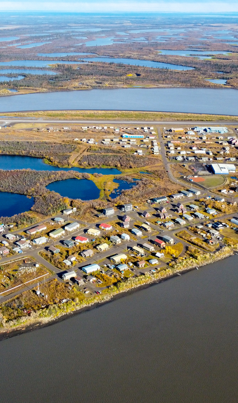
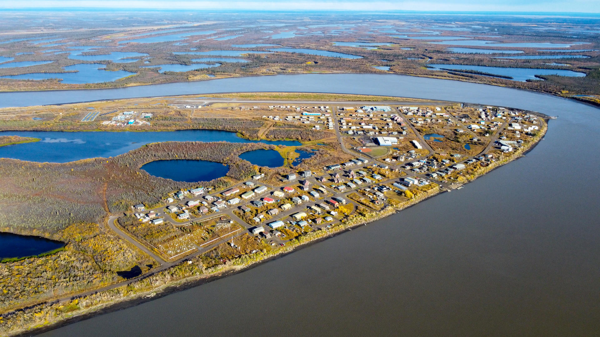
As the climate warms, the frozen soils of the Arctic are thawing. Large amounts of methane and carbon dioxide are released, accelerating climate change. Locally, moreover, the land is subsiding, buildings are becoming unstable, and ecosystems and populations are at risk. Where exactly could permafrost disappear in the future, and where do people need to prepare? To make better predictions, students are helping to map it with high-resolution drone and satellite imagery.


When frozen, the ground is as hard as concrete. But it turns into black mush when it thaws. “It’s like the stuff used in mudpacks at spas,” says Christian Thiel from the German Aerospace Center (DLR). “For the people living there, it’s a huge problem.” Thiel works at the Institute of Data Science and heads DLR’s part of UndercoverEisAgenten, a project for Arctic permafrost research sponsored by Germany’s Federal Ministry of Education and Research. “Situations we can’t imagine are normal in parts of Siberia. Every year they have to fix roads, and houses sink deep into the ground, sometimes up to the second floor.”
In recent decades, temperatures in the Arctic have been rising almost four times as fast as the global average. The cause is polar amplification, a complex process in which climate change is intensified by the special conditions in the Arctic. Warming in this region thaws the permafrost, causing soils that have been frozen down deep for years to thaw more and more from the bottom up during the summer. Microbes that had been dormant become active and begin to metabolize the organic material in the soil. Carbon that was bound in the frozen soil is released in the form of carbon dioxide and methane. These greenhouse gases end up in the atmosphere and contribute to global warming, which thaws even more permafrost – a vicious circle.


We already have initial models of permafrost development. But why does the ground thaw more in some places and less in others, even though the climate is similar? This is a question that research has no answer for. Observational data is needed for a better understanding of regional peculiarities in permafrost regions. The UndercoverEisAgenten project aims to gather such data. “The project’s aim is to work with local people to improve our knowledge and be able to make more reliable forecasts about permafrost development,” says Soraya Kaiser from the Alfred Wegener Institute, Helmholtz Centre for Polar and Marine Research (AWI). Because indigenous people know their land very well and know where the permafrost is thawing, they can help scientists track it better.
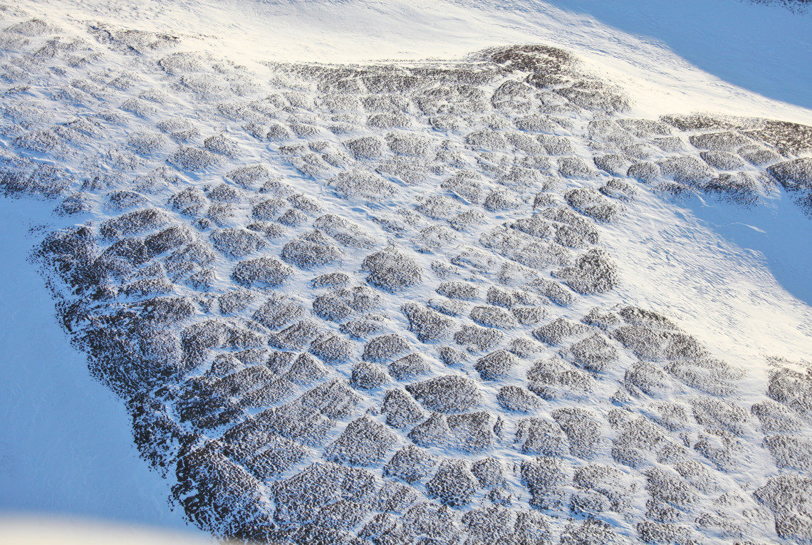
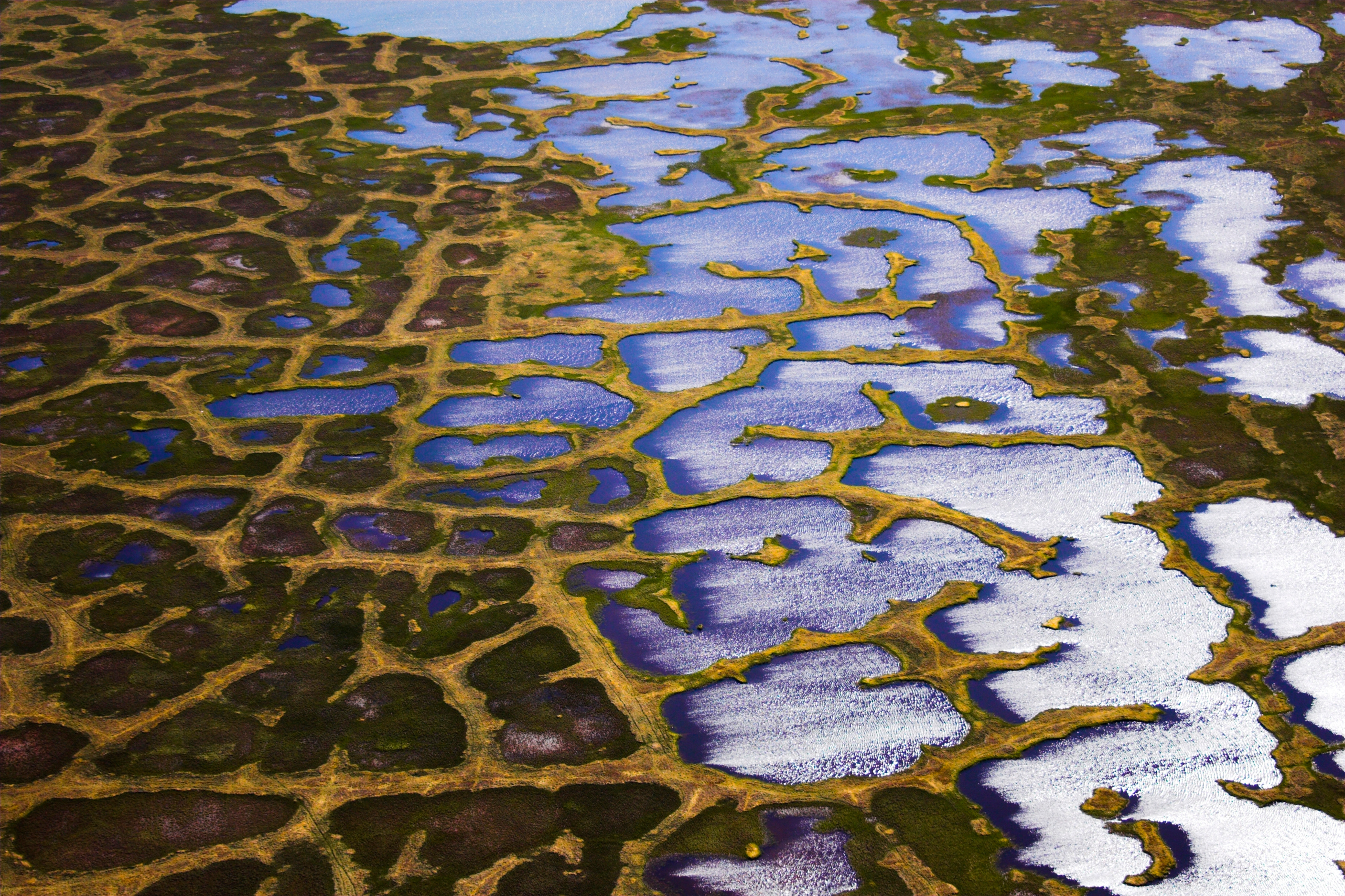
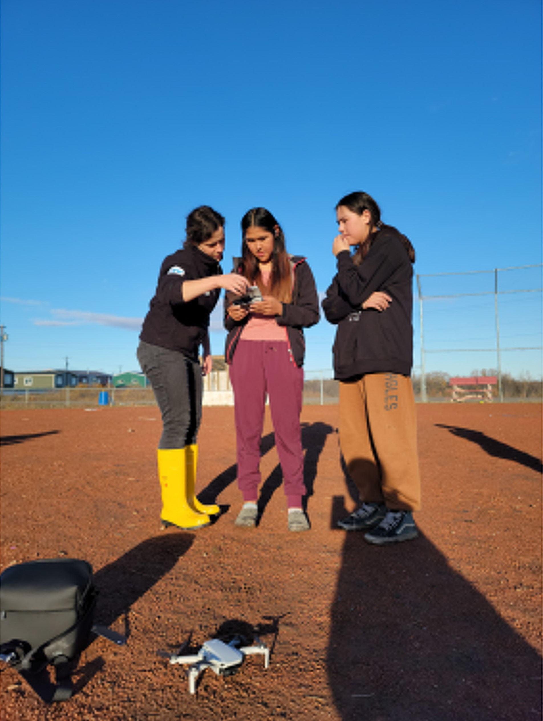
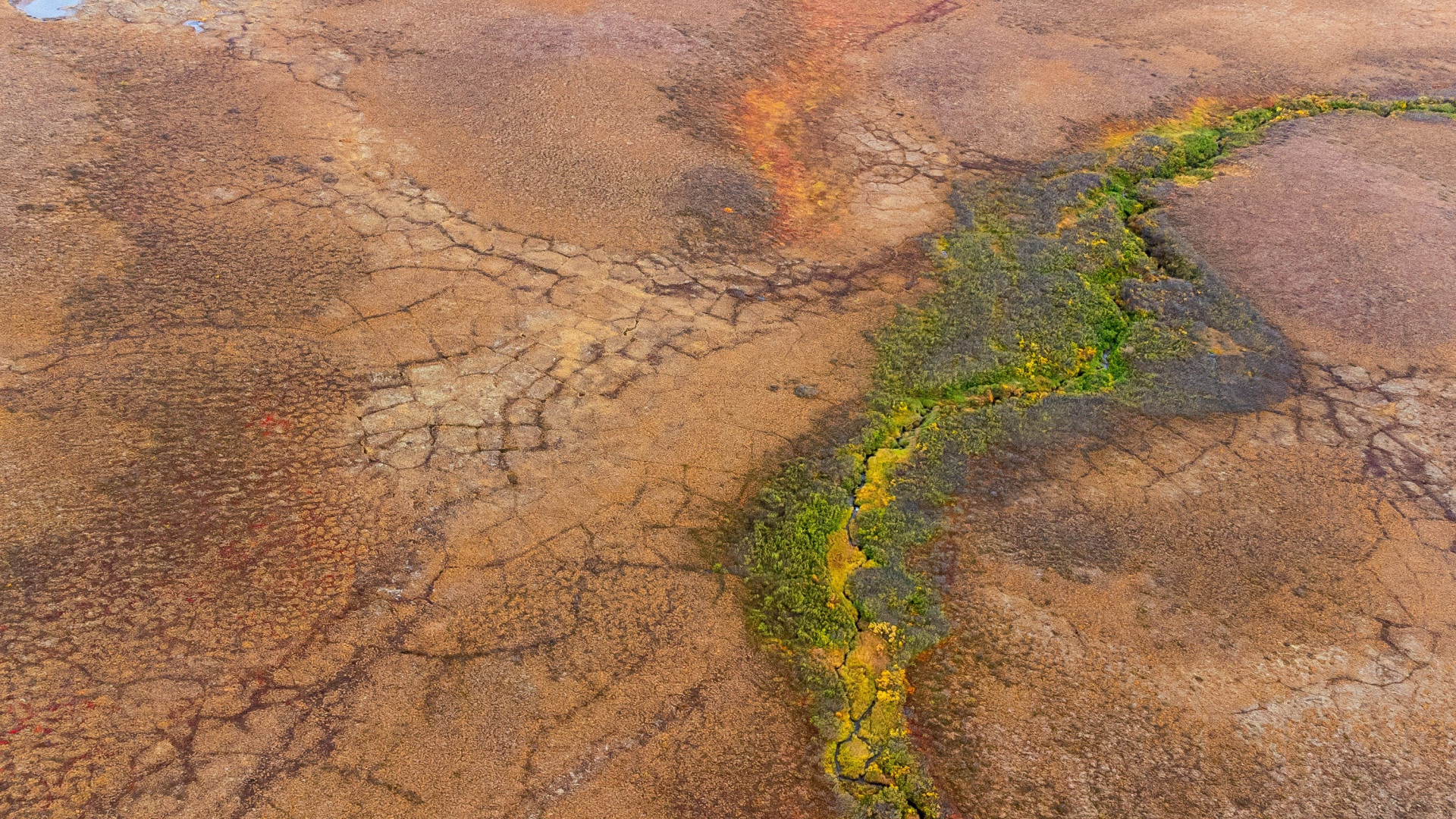
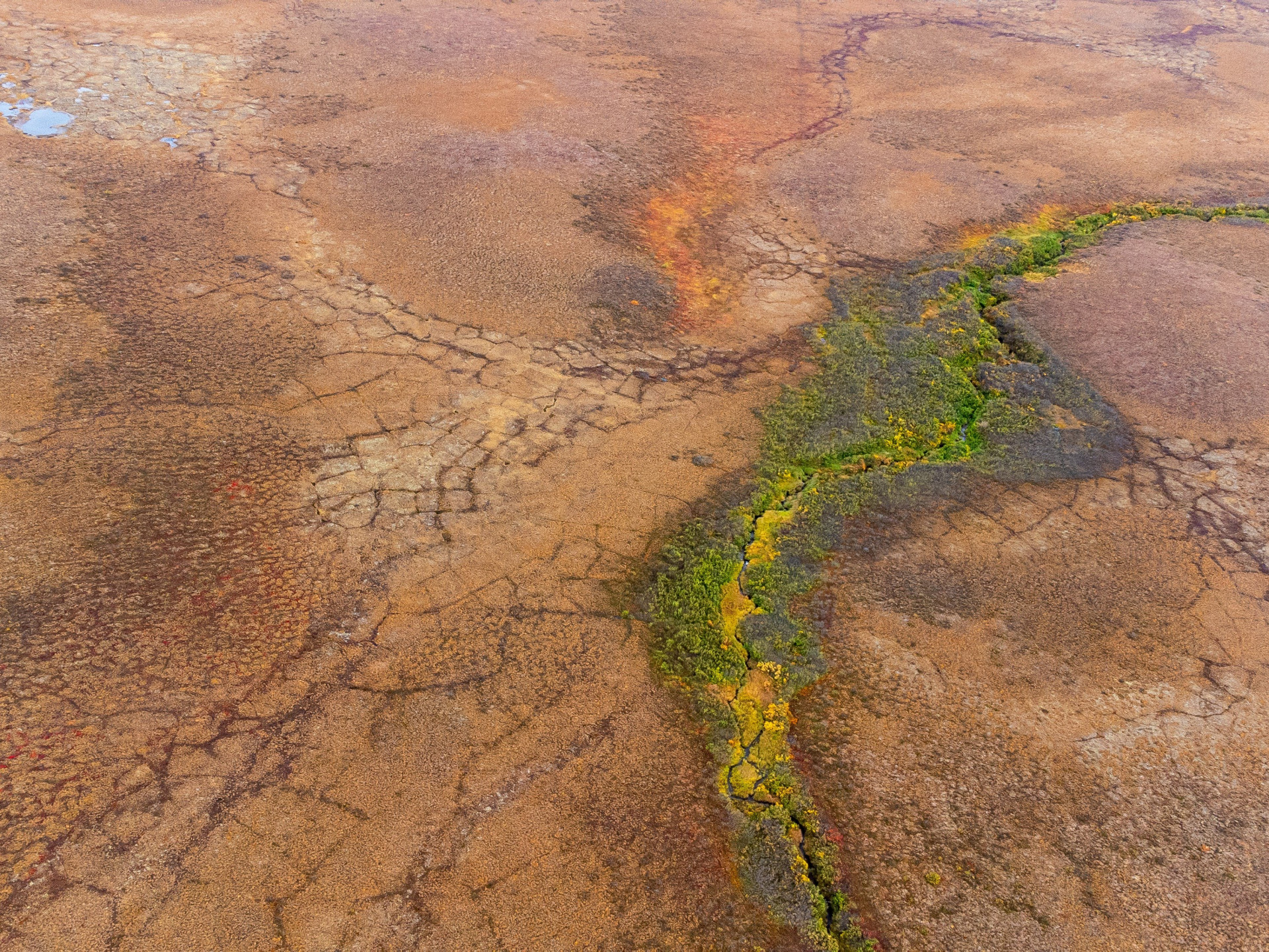
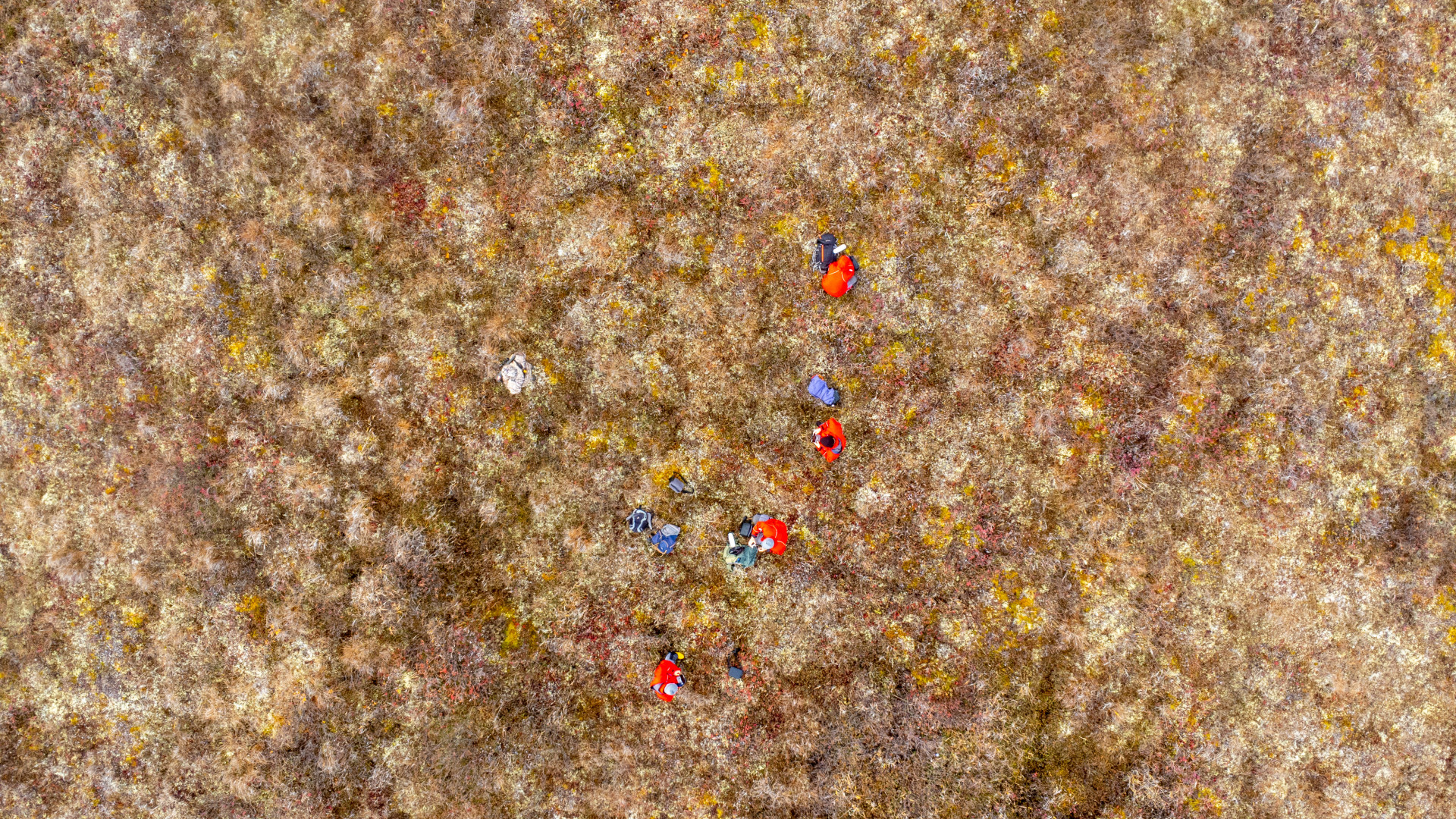
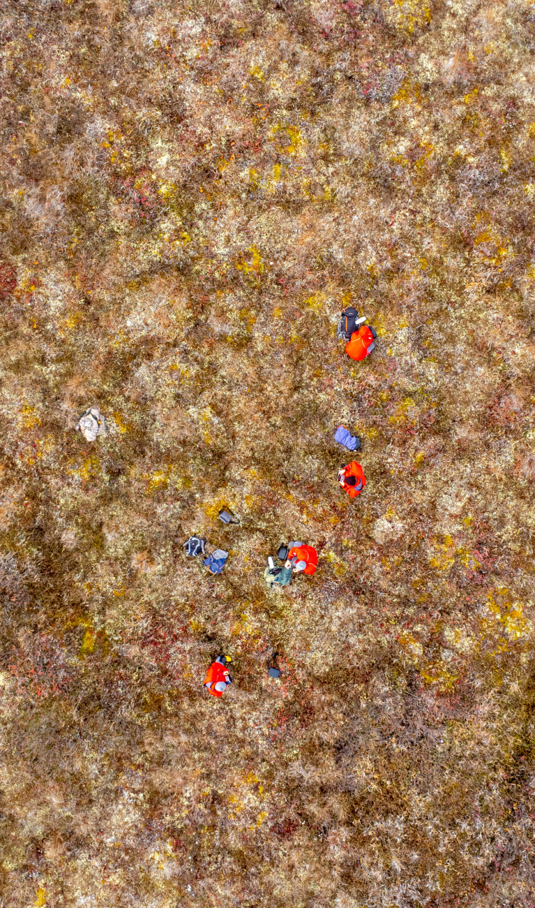
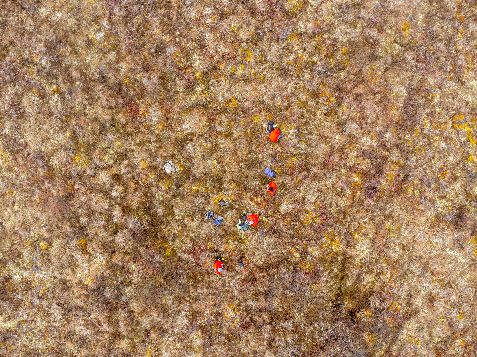
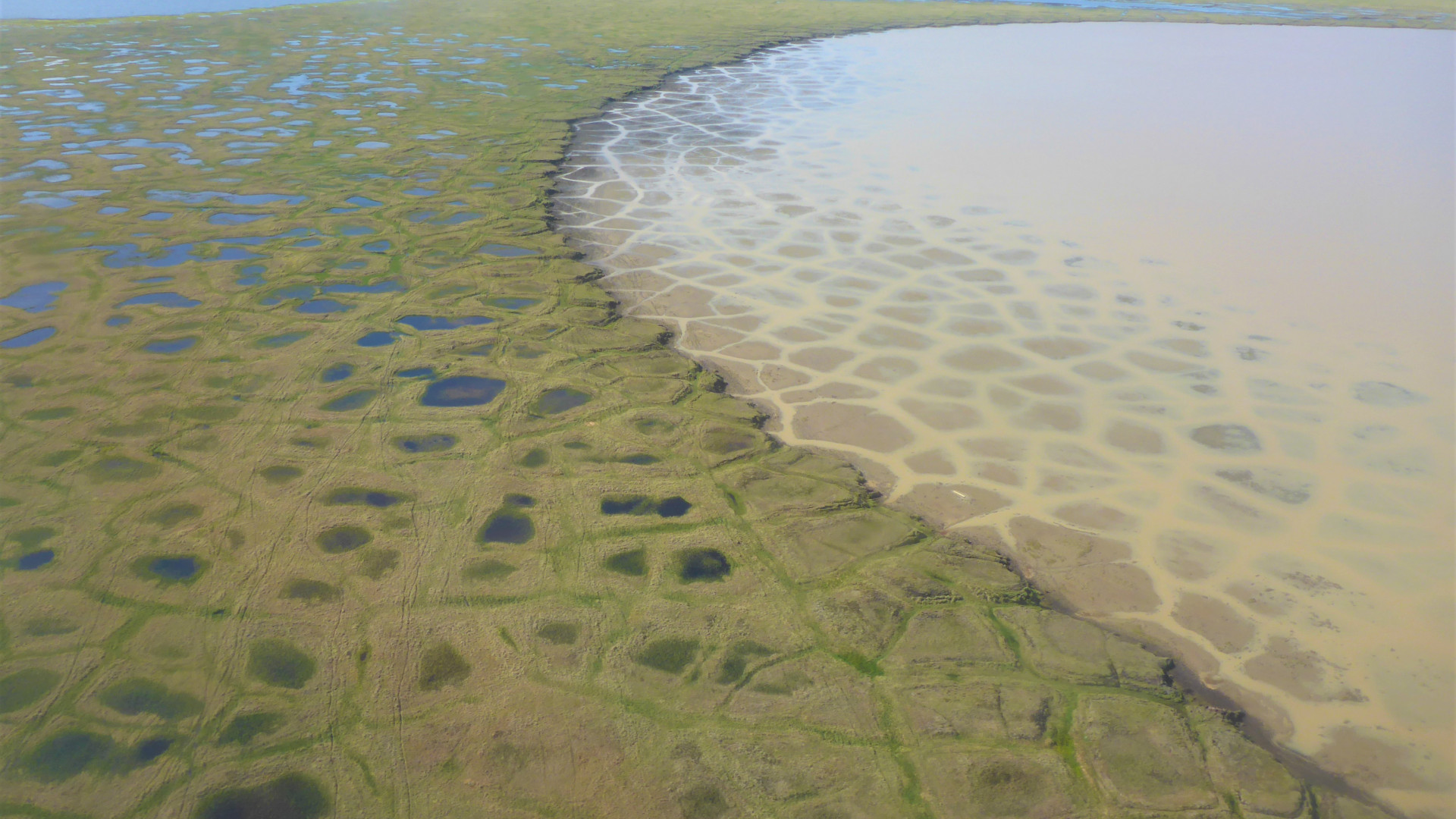
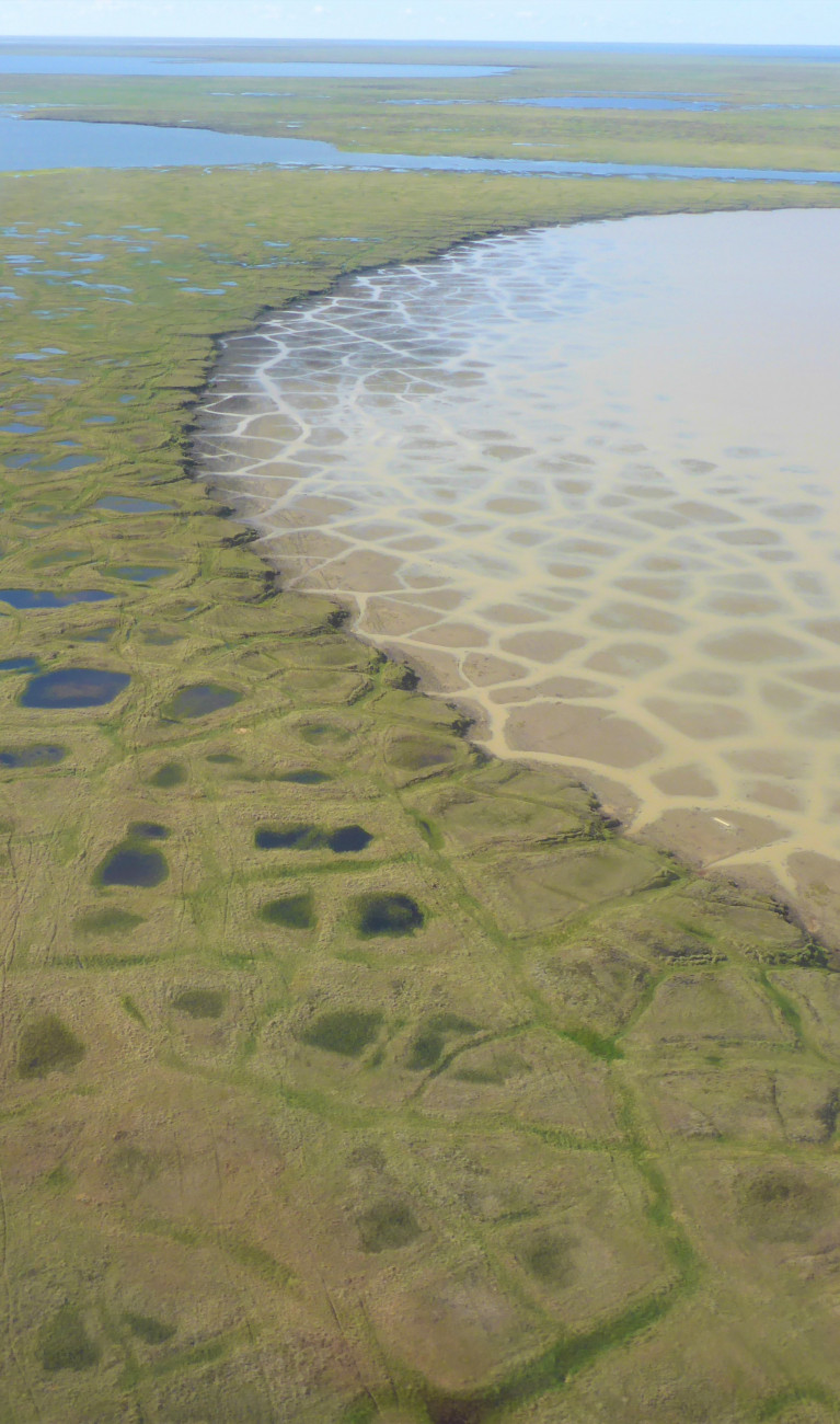
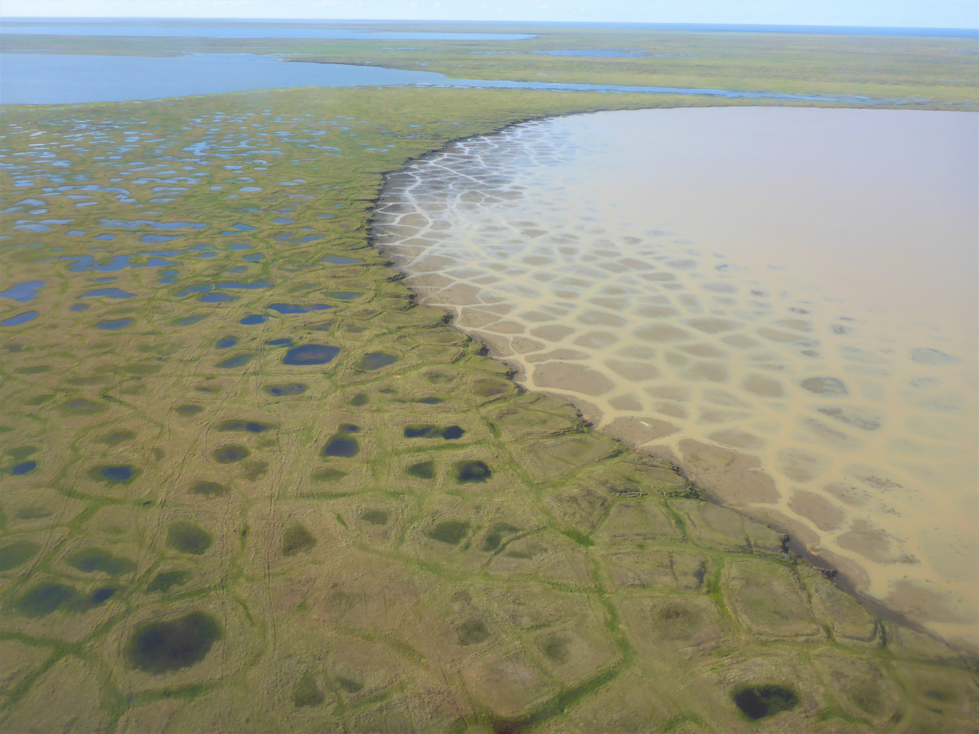
Polygonal structures on the surface allow an assessment from the air of the condition of subsurface permafrost. Since the first signs of permafrost degradation appear at scales on the order of centimeters to decimeters, high-resolution imagery is needed. In the Canadian town of Aklavik, schoolchildren are working in the UndercoverEisAgenten project to explore the soil with drones. From an elevation of about 100 meters, they take pictures according to a specified pattern to measure the position of small structures with centimeter precision.
The German Aerospace Center then processes the students' data from Aklavik. A large photo is created from several hundred small photos and then a detailed 3D image of the terrain. This data is then analyzed by students in Germany and Canada by using a mobile app.
Using the app developed by the Heidelberg Institute for Geoinformation Technology (HeiGIT), the students then map conspicuous structures and changes in the land surface. The smartphone app shows the young researchers what stable and thawing permafrost looks like. Afterwards, the results are sent back to the researchers and are further analyzed, for example at DLR, using artificial intelligence to make statements about the condition of the soil. At the Alfred Wegener Institute, researchers also feed the data obtained into their climate models to improve the calculation of future scenarios. The extent to which climate change will alter permafrost and thus the lives of people in the region is still the subject of research.
Through the project "UndercoverEisAgenten", students contribute to research and want to raise awareness of the problem and its solutions: to act in a more climate-friendly way.


The project is funded by the Federal Ministry of Education and Research as part of the Citizen Research funding area. Partners of this joint project are the Alfred Wegener Institute, Helmholtz Centre for Polar and Marine Research (AWI), the German Aerospace Center (DLR) and the Heidelberg Institute for Geoinformation Technology (HeiGIT).